Directions to start
A limited bus service operates to this walk location, however we'd recommend taking your car.

A limited bus service operates to this walk location, however we'd recommend taking your car.
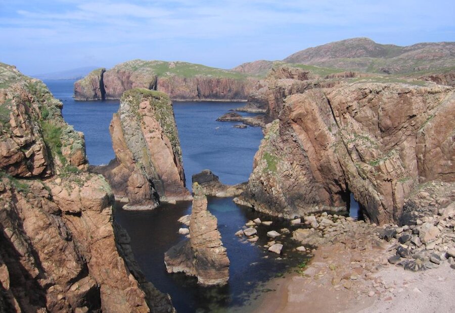
The Hams of Muckle Roe gets their names from Old Norse and translates as the Havens (or Harbours) of the Big Red Island. This walk route to The Hams begins at the end of the road at Little-Ayre. Please take note of the signs and park responsibly.
From the parking area follow the track between the houses bearing left to head down to Muckle Ayre, a beautiful secluded red beach. The path to the Lighthouse is signposted and it’s this that you will follow.
This coast has many caves and stacks and just before the lighthouse you will pass the Hole of Hellier which has subterranean passages to it. From here you can enjoy the view out to Vementry with its First World War guns on the headland of Swarbacks Head. The original lighthouse is now in the Sumburgh Head carpark as a tourist information point with a modern electronic one taking its place on the cliff tops here now.
From the lighthouse follow less defined paths north east along the coast towards South Ham passing impressive sea stacks like ‘The Spindle’ off the red granite cliffs along the way.
South Ham was a stopping off point in the 19th Century for smacks returning from the Faeroe cod fishery; not to land fish, but contraband. From the shore of South Ham you can continue north around the headland to ascend Strom Ness. From the highest point above the massively stone built croft of Burg you will get a magnificent view north across the Hams.
From the harbour of South Ham cross the hillside to Town Loch and another impressive natural harbour at North Ham. From the North Ham you can take a detour north to ascend the headland overlooking the Ham which opens up a spectacular view south back towards Strom Ness. From here you then follow the shore south past Town Loch and then the obvious track south west through the hills back to the start at Little-Ayre.